wizehop
Chasing the Darkness
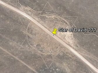
I was checking out this site to look over yard photos like the one below and came to find a ton of insane areal shots. Visit the website for much more:
http://www.dailyoverview.nyc/twentyfour

In Norfolk, Virginia, Lamberts Point Pier 6 is the largest coal-landing station in the Northern Hemisphere

5/16/2015
Micoalgae growing ponds
Kailua-Kona, Hawaii, USA
19.726648398°, -156.053648787°
Growing pools containing various species of microalgae - a microscopic plant - are seen at Cyanotech in Kailua-Kona, Hawaii, USA. The company uses microalgae to develop a number of products such as food coloring agents. Microalgae, on the whole, produce approximately half of the planet’s atmospheric oxygen and simultaneously use the greenhouse gas carbon dioxide to grow using photosynthesis.

5/15/2015
Juscelino Kubitschek Bridge
Brasilia, Brazil
15°49′25″S 47°49′46″W
The Juscelino Kubitschek Bridge is a steel and concrete structure that crosses Lake Paranoá in Brasília, Brazil. The main span has four supporting pillars submerged underwater, while the deck weight is supported by three 200-foot-tall (61 m) asymmetrical steel arches that crisscross diagonally over the bridge.

5/14/2015
Shivaji Nagar No: 1 and No: 2
Mumbai, India
19.061699428°, 72.927082280°
Shivaji Nagar No: 1 and No: 2 are two densely populated neighborhoods in Mumbai, India. The area is home to more than 200,000 residents, primarily immigrants from Uttar Pradesh and Bihar (located in Eastern and Northern India, respectively) as well as Bangladesh who have come to Mumbai in search of a better life. The vast majority of the homes here do not have plumbing, running water taps, bathtubs, or toilets.

5/13/2015
Lake Hood Seaplane Base
Anchorage, Alaska, USA
61°10′54″N 149°57′59″W
The Lake Hood Seaplane Base, captured here during the frozen-over winter, is located in Anchorage, Alaska, USA. Handling an average of 190 flights per day, the facility is the world's busiest airport for seaplanes.

Today we’re excited to feature this incredible shot of a coal train yard in Virginia, shared with us by aerial photographer Cameron Davidson. To see more of his breathtaking shots, you can check out his book "Chesapeake: The aerial photography of Cameron Davidson” or on his feed@camdavidsonphoto.

5/11/2015
Residential / agricultural development
Jiulongzhen, Anhui, China
31.887639391°, 121.646788019°
Individual homes and agricultural lots stretch across the landscape of Jiulongzhen in the Anhui Province of China.

5/9/2015
Malé
Malé, Republic of Maldives
04°10′31″N 073°30′32″E
Malé is the capital and most populous city in the Republic of Maldives. With more than 47,000 residents per square kilometer, the heavily urbanized city constitutes the fifth most densely populated island in the world.

5/8/2015
Pivot irrigation
Kansas, USA
39°20′14″N 101°32′26″W
To celebrate the weekend (and to thank you for all for helping us hit the 35k follower milestone!), we wanted to have our first Printshop giveaway. Simply tag three friends on our Instagram feed to be entered to win a 7.5” x 10” print of these pivot irrigation fields in Kansas. The circles that you see are created when lines of sprinklers that are powered by electric motors rotate 360 degrees to evenly irrigate crops. A winner will be randomly selected in 48 hours. Thanks!

5/7/2015
Thomson Correctional Center
Thomson, Illinois, USA
41°58′20″N 90°6′30″W
Thomson Correctional Center is maximum security prison located in Thomson, Illinois, USA. The facility has a capacity of 1,600 prisoners that are held within eight cellhouses, surrounded by a 15-foot, 7000 volt electric fence and an additional 12-foot fence covered with razor wire.

5/6/2015
Pyramids of Giza
Giza, Egypt
29°58′34″N 31°7′58″E
The Great Pyramids of Giza are located on the outskirts of Cairo, Egypt. Dating back to 2580 BC, the Great Pyramid, the largest structure at the site, is the oldest of the Seven Wonders of the Ancient world and the only one to remain largely intact. With an estimated 2,300,000 stone blocks weighing from 2 to 30 tons each, the 481 foot pyramid was the tallest structure in the world for more than 3,800 years.
CLICK HERE TO SEE MORE
http://www.dailyoverview.nyc/twentyfour
In Norfolk, Virginia, Lamberts Point Pier 6 is the largest coal-landing station in the Northern Hemisphere
5/16/2015
Micoalgae growing ponds
Kailua-Kona, Hawaii, USA
19.726648398°, -156.053648787°
Growing pools containing various species of microalgae - a microscopic plant - are seen at Cyanotech in Kailua-Kona, Hawaii, USA. The company uses microalgae to develop a number of products such as food coloring agents. Microalgae, on the whole, produce approximately half of the planet’s atmospheric oxygen and simultaneously use the greenhouse gas carbon dioxide to grow using photosynthesis.
5/15/2015
Juscelino Kubitschek Bridge
Brasilia, Brazil
15°49′25″S 47°49′46″W
The Juscelino Kubitschek Bridge is a steel and concrete structure that crosses Lake Paranoá in Brasília, Brazil. The main span has four supporting pillars submerged underwater, while the deck weight is supported by three 200-foot-tall (61 m) asymmetrical steel arches that crisscross diagonally over the bridge.
5/14/2015
Shivaji Nagar No: 1 and No: 2
Mumbai, India
19.061699428°, 72.927082280°
Shivaji Nagar No: 1 and No: 2 are two densely populated neighborhoods in Mumbai, India. The area is home to more than 200,000 residents, primarily immigrants from Uttar Pradesh and Bihar (located in Eastern and Northern India, respectively) as well as Bangladesh who have come to Mumbai in search of a better life. The vast majority of the homes here do not have plumbing, running water taps, bathtubs, or toilets.
5/13/2015
Lake Hood Seaplane Base
Anchorage, Alaska, USA
61°10′54″N 149°57′59″W
The Lake Hood Seaplane Base, captured here during the frozen-over winter, is located in Anchorage, Alaska, USA. Handling an average of 190 flights per day, the facility is the world's busiest airport for seaplanes.
Today we’re excited to feature this incredible shot of a coal train yard in Virginia, shared with us by aerial photographer Cameron Davidson. To see more of his breathtaking shots, you can check out his book "Chesapeake: The aerial photography of Cameron Davidson” or on his feed@camdavidsonphoto.
5/11/2015
Residential / agricultural development
Jiulongzhen, Anhui, China
31.887639391°, 121.646788019°
Individual homes and agricultural lots stretch across the landscape of Jiulongzhen in the Anhui Province of China.
5/9/2015
Malé
Malé, Republic of Maldives
04°10′31″N 073°30′32″E
Malé is the capital and most populous city in the Republic of Maldives. With more than 47,000 residents per square kilometer, the heavily urbanized city constitutes the fifth most densely populated island in the world.
5/8/2015
Pivot irrigation
Kansas, USA
39°20′14″N 101°32′26″W
To celebrate the weekend (and to thank you for all for helping us hit the 35k follower milestone!), we wanted to have our first Printshop giveaway. Simply tag three friends on our Instagram feed to be entered to win a 7.5” x 10” print of these pivot irrigation fields in Kansas. The circles that you see are created when lines of sprinklers that are powered by electric motors rotate 360 degrees to evenly irrigate crops. A winner will be randomly selected in 48 hours. Thanks!
5/7/2015
Thomson Correctional Center
Thomson, Illinois, USA
41°58′20″N 90°6′30″W
Thomson Correctional Center is maximum security prison located in Thomson, Illinois, USA. The facility has a capacity of 1,600 prisoners that are held within eight cellhouses, surrounded by a 15-foot, 7000 volt electric fence and an additional 12-foot fence covered with razor wire.
5/6/2015
Pyramids of Giza
Giza, Egypt
29°58′34″N 31°7′58″E
The Great Pyramids of Giza are located on the outskirts of Cairo, Egypt. Dating back to 2580 BC, the Great Pyramid, the largest structure at the site, is the oldest of the Seven Wonders of the Ancient world and the only one to remain largely intact. With an estimated 2,300,000 stone blocks weighing from 2 to 30 tons each, the 481 foot pyramid was the tallest structure in the world for more than 3,800 years.
CLICK HERE TO SEE MORE